- 35Cruising grounds
- 52×chart updates a year
- 3chart modes: day, dusk, night
Aboard
The app in use.
Instruments like the ones at the chart table. A chart nothing gets in the way of. A night mode that spares your eyes.
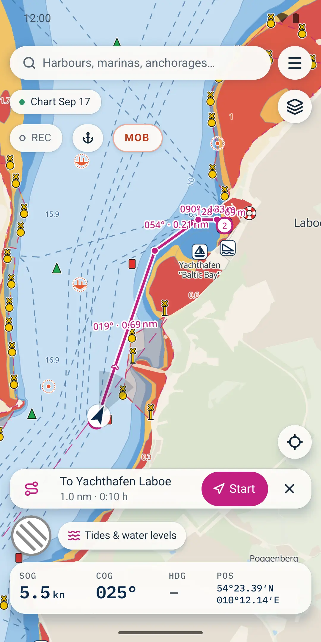
Autorouting: plan the route, then start it with one tap. 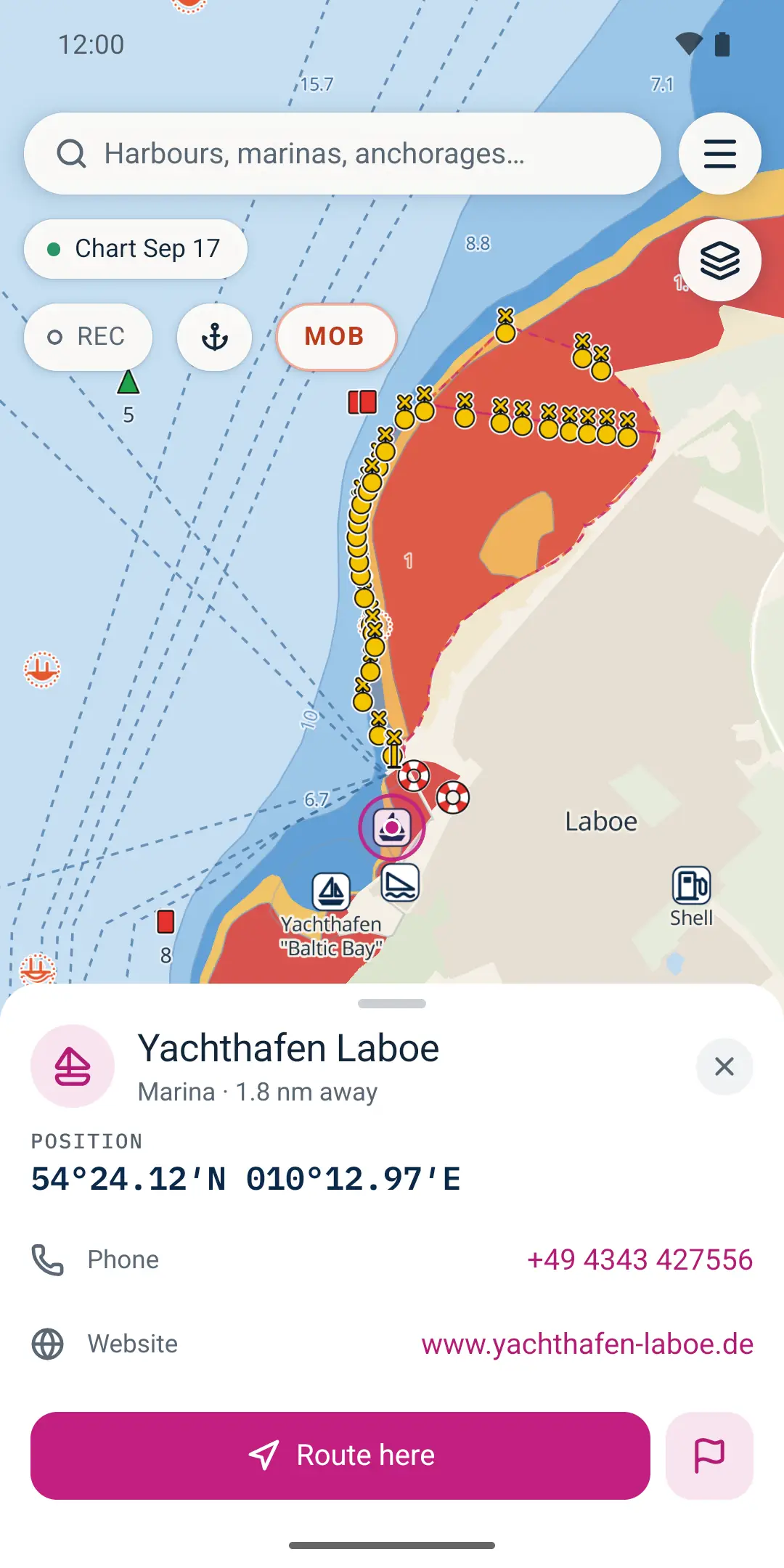
Harbours and places: tap, route here, done. 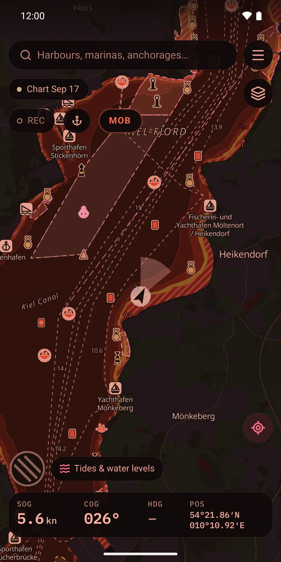
Night mode: red, so your night vision stays.
Legend
Everything that matters aboard.
A complete navigation app for cruising sailors and motorboaters.
- The chart
- A clean vector chart from OpenStreetMap and OpenSeaMap, depth bands from EMODnet bathymetry. Seamarks, lights, harbours, anchorages. Day, dusk and a red night mode for the watch.
- Offline first
- Download a region once and everything keeps working without coverage: chart, search, autorouting, your data. Online adds water levels and AIS. Weather is coming in a later update.
- Routes & navigation
- Plan routes on the chart and follow them with bearing, distance, cross-track error and ETA. Autorouting (beta) knows your draft, avoids land and restricted areas and treats unknown depths as shallow.
- Depth & speed
- Enter draft, air draft, cruising speed and safety margin once. Kurshalter warns you about shallow water ahead and shows the speed limit where zone data exists.
- Tracks & alarms
- Record your track with the screen off, export and import GPX. The anchor alarm keeps watch while you sleep.
- AIS & water levels
- German water levels from PEGELONLINE and live AIS traffic around your chart view. Weather forecasts are coming in a later update.
- Privacy
- No account. Ads stay outside active navigation. Your routes, tracks and settings stay on your device.
Cruising grounds
Where will you go next?
The published catalogue includes 35 offline cruising grounds in Europe and the USA, plus 4 reference charts for viewing. Coverage and features vary by source; US charts do not support autorouting. The base map works worldwide.
Europe at a glance. Explore all regions by coast below.
North Sea7
- Danish North Sea Coast277 MB
- Dutch Wadden & IJsselmeer510 MB
- East Frisian Coast311 MB
- German Bight & North Frisia327 MB
- Limfjord302 MB
- Skagerrak & Northern Jutland249 MB
- Zeeland & Delta437 MB
Baltic & Scandinavia11
- Bohuslän and OslofjordComing soon
- Bornholm & Hanö Bay308 MB
- Fyn, Belts & Samsø414 MB
- Kattegat373 MB
- Kiel Bight & Fehmarn296 MB
- Mecklenburg & Lübeck Bight278 MB
- Øresund347 MB
- Polish Baltic CoastComing soon
- Rügen, Bodden & Usedom279 MB
- Smålandsfarvandet & Møn273 MB
- Stockholm ArchipelagoComing soon
Atlantic & English Channel6
- Algarve and Gulf of Cádiz129 MB
- Atlantic Brittany337 MB
- Central Portuguese CoastComing soon
- Eastern English ChannelComing soon
- Galicia and the RíasComing soon
- Western English ChannelComing soon
Mediterranean15
- Balearic Islands253 MB
- Corsica249 MB
- Costa BravaComing soon
- CreteComing soon
- Dalmatia313 MB
- Dodecanese & East Aegean256 MB
- Gulf of Lion & Côte d'Azur407 MB
- Ionian Islands271 MB
- Ligurian Sea & Elba342 MB
- Naples & Tyrrhenian Coast326 MB
- Northern Adriatic419 MB
- Sardinia320 MB
- Saronic Gulf & Cyclades329 MB
- Sicily & Malta383 MB
- Southern Adriatic & Montenegro251 MB
USA · East Coast3
- Chesapeake Bay421 MB
- Florida Keys58 MB
- Long Island Sound314 MB
USA · West Coast2
- Puget Sound178 MB
- San Francisco Bay191 MB
Inland waters3
Reference charts for viewing. Not for navigation or autorouting.
- Berlin and Brandenburg Waterways3 MB
- German ElbeComing soon
- German Rhine14 MB
Other reference charts2
Reference charts for viewing. Not for navigation or autorouting.
- Auckland approaches / Hauraki Gulf — chart reference6.2 MB
- North Atlantic Seabed38 MB
Download sizes reflect the catalogue date below. Check Offline charts in the app for the current catalogue. Catalogue snapshot: .
Built on open data
Open data, open chart.
Kurshalter is built on open sources and documents how the chart is made. The derived databases are available under the ODbL.
Map data © OpenStreetMap contributors (ODbL) · OpenSeaMap · EMODnet Bathymetry (CC BY 4.0) · Open-Meteo · PEGELONLINE / WSV — Chart data & licences
Privacy
No account. Your routes stay on your device.
Your position goes only to our own server, transiently, for AIS, search and routing. Live sharing temporarily stores your position. See the privacy policy for details.
What works offline?
Download your cruising ground before departure. Charts, place search and autorouting then work without a signal. Live AIS and current water levels need an internet connection.
Is my cruising ground covered?
The published catalogue includes 35 cruising grounds in Europe and the USA. The overview lists available downloads and marks upcoming regions. Planned reference charts do not add navigation coverage. The base map is available worldwide.
Do I need an account?
No account is needed. Your routes, tracks and settings stay on your device. If you share your live position, it is temporarily stored on our server.
The app
On your phone.
For iPhone and Android. Free, with an ad-free chart. The safety basics stay free forever.
For iPhone: coming to the App Store.
For Android: coming to Google Play.
Free · ad-free chart